SPRING 2009
A Newsletter from the Federal Highway Administration (FHWA)
www.gis.fhwa.dot.gov
A Look at MaineDOT's Stimulus Viewer
This month's Q&A is with Nancy Armentrout of the Maine Department of Transportation (MaineDOT). She discusses the department's Stimulus Viewer.
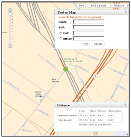 Screen capture from the Stimulus Viewer
Q. What is this application? A. A GIS framework allows for quick and supportable applications to be deployed. The Stimulus Viewer was developed with ArcServer-based architecture and plug-in components that allowed MaineDOT to bundle functionality as needed into an application. With this in place and the stimulus approaching, MaineDOT provided planners with the Stimulus Viewer in less than a week. The Viewer was the second application to be developed with this framework.
Q. How is this application used? A. Information technology (IT) developers use the framework to build applications. The Viewer was linked to the program planning databases and assisted planners to determine which candidate projects across the state should be submitted for stimulus funding.
Quarterly Webcast
On February 23, 2009, FHWA hosted its second quarterly webcast on GIS in Transportation. The topic of the webcast was Iowa DOT's development of a multi-level linear referencing system. Iowa DOT presented to more than 80 participants. More information can be found at www.gis.fhwa.dot.gov/
webinars.aspx
The next webcast is scheduled for late spring 2009.
Q. Who brought the Stimulus Viewer to completion? A. IT staff initiated the development of a GIS framework as a result of dealing with one-off GIS applications and seeing sustainability as a problem. IT developed a proposal for DOT management to develop an architectural framework that was supportable but also allowed for the development of custom applications using common components.
With guidance from the DOT GIS Administrator, three IT staff (all with GIS backgrounds) developed the framework and the Stimulus Viewer. The framework was developed in the fall and winter of 2008-2009. The Stimulus Viewer was built in the last week of January 2009 and refined over the first two weeks of February 2009. Most of the refinements were data-related.
Q. What factors contributed to having it developed that way? A. Over the years, several ArcGIS and ArcIMS applications had been developed. Each provided functionality in a slightly different way depending on the developers who wrote them. It became difficult to support all these applications with the three developers on staff. With the advent of ESRI's ArcServer and particularly ArcServer version 9.3, it became easier to break the applications down into components.
Q. From where do you obtain data for the Stimulus Viewer? A. Spatial data comes from a WMS service for orthophotography, a tiled-image basemap specific to DOT, and the DOT network data from the Spatial Manager summarized into a route system. Tabular data comes from the enterprise project management and asset systems.
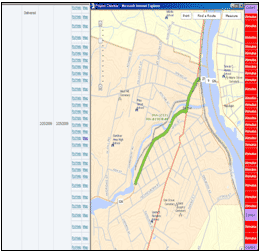 Screen capture from the Stimulus Viewer
Q. there challenges to securing funding for this application? A. The Stimulus Viewer required an ArcServer development license and subscription to ESRI's development network. There was no additional funding identified for the application although the department made a commitment to allow the IT developers time out from other tasks to work on the framework. The department provided patience and the IT developers promised the ability to more quickly deliver applications once the framework was in place.
Q. Has the Viewer met the business and/or technical needs of MaineDOT? A. Yes, it has helped planners produce
their stimulus list. Testimony from customers indicates that users are very pleased with the application.
Q. Are there plans to change/modify this application in the future? A. MaineDOT will add components to the framework toolset as needed. Currently, the Stimulus Viewer is internal to MaineDOT. However, the application may be modified over the next several weeks to be externally-facing.
Q. What have been the critical success factors and/or lessons learned while developing this application? A. Emphasizing the importance of sustainability and component-based development. These factors sold management on allowing developers some up-front time to design and craft the framework. High-level GIS developers in the IT Division also saw the possibilities of ArcServer version 9.3 to improve the department's ability to support GIS applications with a small staff. The Stimulus Viewer was the brainstorm of experienced, GIS-focused developers.
Upcoming Events
- AASHTO's Annual GIS for Transportation Symposium, April 5–8, Oklahoma City, OK
A Database Central Software Neutral Approach
FHWA Guest Editorial from Eric Abrams, Iowa DOT
Many DOTs struggle with creating an enterprise structure for geospatial data storage and availability. Struggles include building cooperation between IT and GIS, lack of an enterprise database, bias toward only use of only one GIS software product, stovepipe applications, the variance of GIS file formats and limited staff knowledge of enterprise geospatial architecture. Some of these obstacles can be overcome by making a change to a database central software neutral approach to GIS.
A database central software neutral approach to GIS is the ability to store geometry and business data in an enterprise database that can be viewed and maintained in multiple ways. For example, Iowa DOT has a linear referencing system (LRS), sign inventory, and paint inventory Oracle Spatial databases. These databases reside in different physical boxes but since they use Oracle Spatial they can be easily mashed together in any software that can read Oracle Spatial Data Option (SDO) geometry objects, such as GeoMedia, ArcGIS server, or TransCAD.
Custom scripts can also be written for batch jobs. One of those batch jobs could determine if 'No Passing' signs are at the correct location based on paint locations and provide custom reports or maps to multiple systems. A common database structure for geometry and business data allows for system flexibility and data integration at a low cost.
In order to achieve a database central software neutral environment, a strong GIS presence in IT with expertise in enterprise database design is a must. This person(s) can interface with offices or a GIS coordinator to migrate data into a common enterprise database structure. Having a strong GIS presence in IT eliminates the "IT does not understand what I do" complaint and provides an IT champion.
Over the past four years, the database central software neutral approach at Iowa DOT has allowed the department to integrate or start to integrate many business data systems from LRS to electronic records management to traffic counts. The database central software neutral approach also creates GIS integration, leverages IT and GIS staff, and removes barriers to GIS integration for the enterprise.
Other News
Recent Reports
Since July 2008, FHWA has released two reports related to applications of GIS for transportation decision-making purposes. These reports listed below, are available along with others at FHWA's GIS in Transportation website: www.gis.fhwa.dot.gov. Visit the site to learn more and submit information about your agency's transportation GIS applications.
GIS Applications for Transportation Right-Of-Way (September 2008) — This report provides a summary of a 1.5-day follow-up peer exchange held in July 2007. The peer exchange was sponsored by the FHWA's Office of Interstate and Border Planning and Office of Real Estate Services.
Key Practices for Implementing Geospatial Technologies for a Planning and Environment Linkages (PEL) Approach (July 2008) — This report presents three case studies that illustrate how GIS has been used to implement the FHWA's PEL approach.

